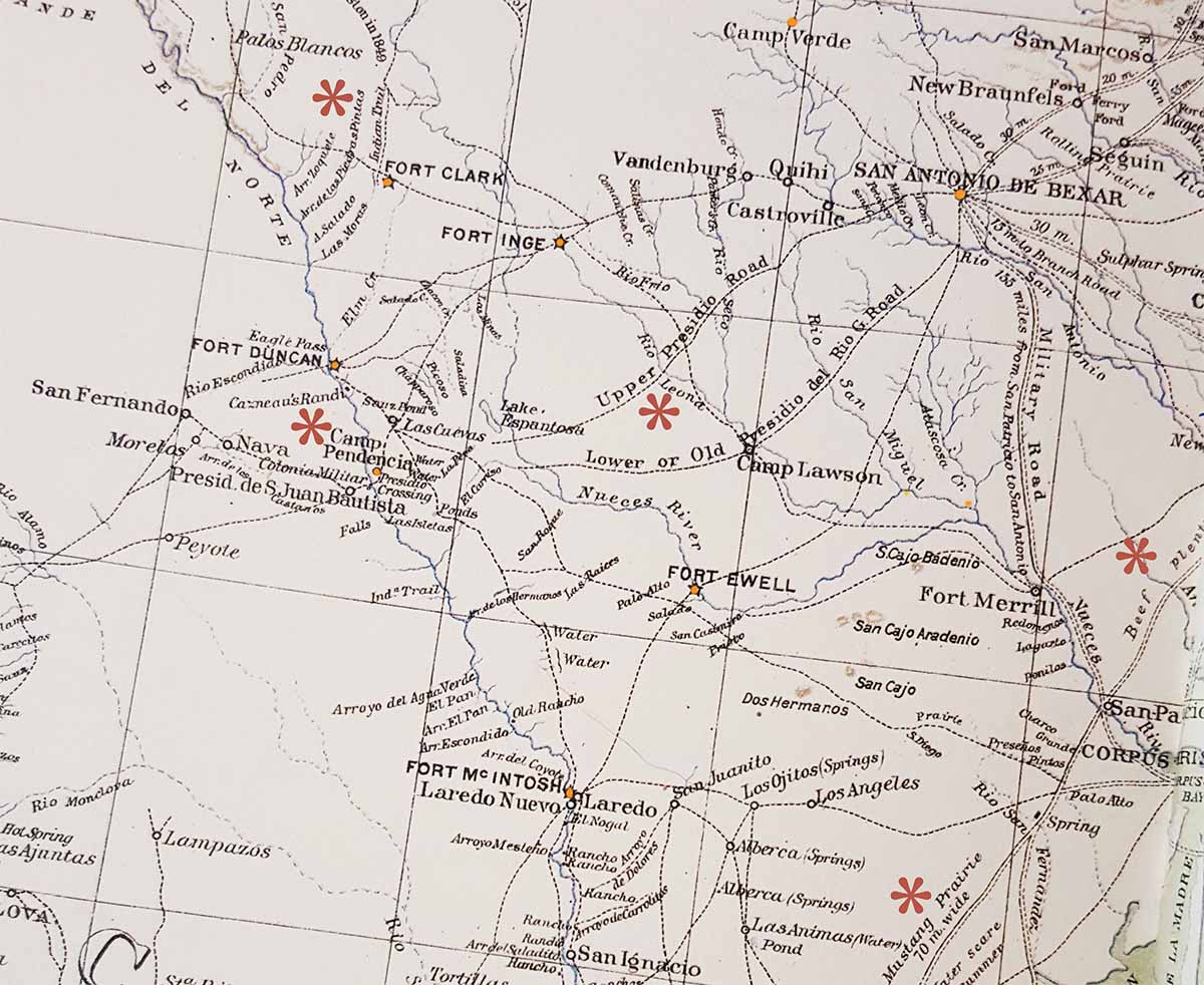
This is an excerpt of a map from The Official Military Atlas of the Civil War: Atlas to Accompany the Official Records of the Union and Confederate Armies, 1861-1865. Plate LIV
This particular map was compiled from various sources from 1846-1857. Accompanying letter of Gen. N.P. Banks, U.S. Army. Series 1 Vol XXXIV Part 2 Page 134.

Items of Interest
Asterick near Fort Clark marks Las Piedras Pintas creek. This was the location of L.D. Lafferty’s rancho as of February 4, 1862, as mentioned in the Lafferty-Cox Agreement.
South of Fort Duncan, we find Camp Pendencia noted on the map. It’s worth noting that young Captain Phillip Sheridan camped along the Pendencia Creek in 1854 and penned notes of his time there in his personal memoirs. Just five years after his visit, Lafferty and others would be the victim of a brutal Indian attack at this same spot.
The Leona River (marked east of Camp Pendencia) is mentioned many times in the Abney book.
The area roughly described by the note “Beef Plenty” was in the vicinity of some large ranches, such as those belonging to the Fagan family, Carlos de la Garza, Thomas O’Connor, the Sideck family and more.
Note regarding “Mustang Prairie 70 miles wide” marks the area where Lafferty and his son, as well as men like Bob Lemmons, would be rounding up horses before, during and after the Civil War.